Weather
Fairly heavy showers above 75 mm are likely at some places in Western and Sabaragamuwa provinces and in Nuwara-Eliya district
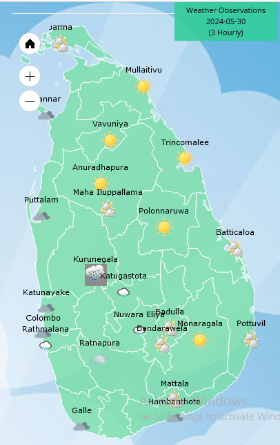
Weather forecast issued at 05.30 a.m. on 30 May 2024 by the Department of Meteorology
The prevailing showery and windy conditions over the island are expected to continue further, due to the active South West Monsoonal condition.
Showers will occur at times in Western, Sabaragamuwa, Central, North-western and Southern provinces. Showers or thundershowers will occur at a few places in Uva province and in Ampara and Batticaloa districts in the evening or night. Fairly heavy showers above 75 mm are likely at some places in Western and Sabaragamuwa province and in Nuwara-Eliya district.
Strong winds of about (50-60) kmph can be expected at times over Western slopes of the central hills and in North-central, Western, Southern and North-western provinces and in Trincomalee and Monaragala districts.
Winds will be westerly to south-westerly in the sea areas around the island. Wind speed will be (40-50) kmph and wind speed may increase up to (60-70) kmph at times.
The sea areas around the island will be rough or very rough due to the active south-west monsoonal condition. Naval and fishing communities are advised not to venture into the sea areas extending from Kankasanthurai to Pottuvil via Mannar, Colombo, Galle and Hambantota, until further notice and be vigilant in the other sea areas around the island.
Waves heights may increase up to (about 2.5 m – 3.5 m) in the sea areas off the coast, extending from Kalpitiya to Pottuvil via Colombo, Galle, and Hambantota. Therefore, there is a possibility that nearshore sea areas extending from Kalpitiya to Matara via Colombo and Galle, may experience surges due to sea waves.


Weather
The prevailing rainy condition in the south-western part of the island is expected to enhance to some extent in the next few days from today (08th)

Weather forecast issued at 05.30 a.m. on 08 June 2024 by the Department of Meteorology
The prevailing rainy condition in the south-western part of the island is expected to enhance to some extent in the next few days from today (08th).
Showers will occur at times in Western, Sabaragamuwa, Northern, North-central, North-western and Southern provinces and in Kandy, Matale and Nuwara Eliya districts. Fairly heavy showers above 50 mm are likely at some places in Western and Sabaragamuwa provinces and in Nuwara Eliya, Galle and Matara districts. Showers or thundershowers may occur at a few places in Uva province and in Ampara and Batticaloa districts in the evening or night.
Winds will be south-westerly and wind speed will be (30-40) kmph. Strong winds of about (40-50) kmph can be expected at times over Northern, North-central, North-western provinces and in Trincomalee and Hambantota districts. Wind speed may increase up to (50-60) kmph at times in the sea areas off the coasts extending from Mullaitivu to Puttalam via Kankasanthurai, Mannar and from Hambantota to Batticaloa via Pottuvil.
The sea areas off the coasts extending from Mullaitivu to Puttalam via Kankasanthurai, Mannar, and from Hambantota to Batticaloa via Pottuvil can be rough at times.Strong gusty winds and very rough seas can be expected during thundershowers. Naval and fishing communities are requested to be attentive in this regard.
General public is kindly requested to take adequate precautions to minimize damages caused by temporary localized strong winds and lightning during thundershowers.
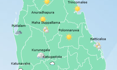
Weather
Showers will occur at times in Western, Sabaragamuwa, North-western, Northern, North-central and Southern provinces and in Kandy and Nuwara Eliya districts
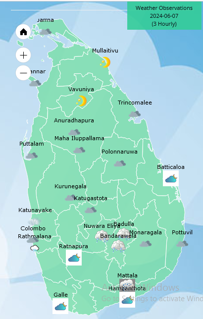
Weather forecast issued at 05.30 a.m. on 07 June 2024 by the Department of Meteorology
Showers will occur at times in Western, Sabaragamuwa, North-western, Northern, North-central and Southern provinces and in Kandy and Nuwara Eliya districts. Showers or thundershowers may occur at a few places in Eastern and Uva provinces in the evening or night.
Winds will be south-westerly and wind speed will be (25-35) kmph. Strong winds of about (40-50) kmph can be expected at times over Northern, North-central, North-western provinces and in the Hambantota district. Wind speed may increase up to (50-60) kmph at times in the sea areas off the coasts extending from Mullaitivu to Puttalam via Kankasanthurai, Mannar and from Hambantota to Pottuvil.
The sea areas off the coasts extending from Mullaitivu to Puttalam via Kankasanthurai, Mannar, and from Hambantota to Pottuvil can be rough at times while strong gusty winds and very rough seas can be expected during thundershowers. Naval and fishing communities are also requested to be attentive in this regard.
General public is kindly requested to take adequate precautions to minimize damages caused by temporary localized strong winds and lightning during thundershowers.
Weather
Showers in Western, Sabaragamuwa, Southern, Northern, North-central and North-western provinces and in Kandy and Nuwara Eliya districts

Weather forecast issued at 05.30 a.m. on 06 June 2024 by the Department of Meteorology
Several spells of showers will occur in Western, Sabaragamuwa, Southern, Northern, North-central and North-western provinces and in Kandy and Nuwara Eliya districts. Showers or thundershowers may occur at a few places in Eastern and Uva provinces in the evening or night.
Winds will be south-westerly and wind speed will be (25-35) kmph. Strong winds of about (40-50) kmph can be expected at times over Northern, North-central, North-western provinces and in Hambantota district. Wind speed may increase up to (50-60) kmph at times in the sea areas off the coasts extending from Mullaitivu to Puttalam via Kankasanthurai, Mannar and from Hambantota to Pottuvil.
The sea areas off the coasts extending from Mullaitivu to Puttalam via Kankasanthurai, Mannar, and from Hambantota to Pottuvil can be rough at times. Strong gusty winds and very rough seas can be expected during thundershowers. Naval and fishing communities are also requested to be attentive in this regard.
General public is kindly requested to take adequate precautions to minimize damages caused by temporary localized strong winds and lightning during thundershowers.


US sports envoys to Lanka to champion youth development

Rahuman questions sudden cancellation of leave of CEB employees


